Last updated on August 1, 2025
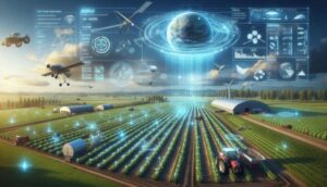
Remember that feeling of standing in a vast field, wondering if a dry patch far off was just thirsty soil or something more serious? Or perhaps gazing at your crops, wishing you had an eagle’s eye view to catch early signs of trouble? Well, that ‘eagle’s eye’ isn’t a wish anymore; it’s a reality, beamed directly from space.
You’ve likely heard the buzz about satellite technology in our Ultimate Guide to Agritech in Nigeria. Now, let’s zoom in on one of its most revolutionary aspects: Satellite Imagery and Remote Sensing. This guide isn’t just theory; it’s your practical handbook for harnessing data from orbiting satellites to gain an unparalleled, unbiased perspective on your entire farming operation. We’ll show you how to truly interpret these celestial insights, enabling you to pinpoint problems, optimize precious resources, and make smarter, more profitable decisions for a thriving, resilient farm.
Executive Summary / Key Takeaways
- Your Farm, Seen from Above: Satellite imagery offers a unique, comprehensive view of your farm’s health and performance, providing insights you can’t get from the ground.
- Catch Problems Early: Metrics like NDVI act as an early warning system, flagging stress from drought, pests, or nutrient deficiencies before they become critical.
- Optimize Every Drop and Grain: Use data to precisely apply water and inputs, significantly reducing waste and operating costs.
- Decisions Backed by Data: Move beyond guesswork. Satellite data transforms intuition into informed, proactive choices for better yields and sustainable practices.
- Technology for Every Farmer: User-friendly platforms now make powerful satellite data accessible, even if you’re not a tech expert.
Why Satellite Imagery is a Game-Changer for Farmers
Satellite imagery isn’t just about captivating photos from space; it’s a dynamic data powerhouse fundamentally transforming farm management. Here’s why this cosmic perspective is revolutionizing agriculture:




- Unprecedented Scale & Scope: Imagine monitoring hundreds or thousands of acres from the comfort of your mobile phone or computer. Satellite imagery lets you identify large-scale patterns and emerging issues across vast areas—problems virtually impossible to spot from your boots on the ground.
- Your Farm’s Early Warning System: Detect subtle signs of crop stress, pinpoint water imbalances, or even foresee pest outbreaks days or weeks before they’re visible to the naked eye. This allows for truly proactive intervention, saving your crops and your profits.
- Precision Input Optimization: No more guessing games. Pinpoint precisely where your fields need more or less water, fertilizer, or pesticides. This leads to substantial savings on expensive inputs and significantly reduces your environmental footprint.
- Unlocking Historical Insights: Analyze performance trends across seasons and even years. Understand how specific areas of your farm consistently perform, diagnose persistent issues, and refine your long-term strategies with invaluable historical data.
- Effortless Remote Monitoring: Keep a vigilant eye on distant fields or areas difficult to access without physically visiting them. This translates to significant savings in time, fuel, and labor, especially for large or geographically dispersed operations.
Understanding the ‘Eyes in the Sky’: Key Data Types from Satellite Imagery
Remote sensing satellites constantly sweep across Earth’s orbit, capturing intricate images of your fields using various wavelengths of light. Many of these wavelengths are beyond human perception, yet they hold the secret to revealing the hidden health and vitality of your crops, uncovering patterns that are simply invisible from the ground.
| Data Type | What it Measures / How it Works | Primary Use for Farmers |
|---|---|---|
| Normalized Difference Vegetation Index (NDVI) | This powerful metric quantifies plant health by comparing how much near-infrared light (strongly reflected by healthy plants) versus red light (strongly absorbed by healthy plants) is returned. A higher value indicates more vigorous, healthy vegetation. | Crop Health Score: Quickly identify zones of stress (from drought, pests, or nutrient deficiency), monitor crucial growth stages, and assess overall crop vigor. |
| Visible Light (RGB) | These are your standard, true-color images (Red, Green, Blue) that closely mimic what the human eye sees. | Visual Monitoring: Track noticeable changes in crop color, observe distinct patterns of damage, and monitor general growth and development. |
| Thermal Imaging | Utilizing advanced thermal sensors, this data type detects the precise temperature of the plant canopy. Plants under water stress often close their stomata, causing them to warm up. | Water Stress Detection: Spot early signs of drought stress days before wilting, pinpoint inefficiencies in your irrigation system, and optimize water application. |
| Radar (SAR) | Synthetic Aperture Radar is a groundbreaking technology that emits and receives microwave signals capable of penetrating cloud cover and even light vegetation. It measures the time and strength of the returned signal. | Soil Moisture Mapping: Accurately assess surface-level soil moisture content, even during consistently cloudy or rainy seasons, providing reliable data regardless of weather conditions. Can also offer insights into crop height and structure. |
Putting Satellite Data to Work on Your Farm: Practical Applications
You absolutely don’t need a degree in data science to derive immense value from satellite imagery. Here are the most practical and impactful ways this technology can transform your daily farming operations:
Supercharged Crop Scouting: How to Focus Your Efforts Precisely
Imagine no longer walking or driving aimlessly through hundreds of acres. With a recent satellite image, you can instantly direct your attention. The NDVI map, for instance, will vividly display “hotspots” of potential trouble (often highlighted in yellows and reds). You can then navigate directly to those specific locations for targeted “ground-truthing,” saving enormous amounts of time, fuel, and labor. This precision scouting makes your efforts highly efficient and remarkably proactive.
- Real-World Impact: A landmark 2024 study published in Remote Sensing of Environment underscored the power of this approach, finding that using NDVI-based monitoring for early intervention and targeted scouting reduced overall crop losses by an impressive 22%.
Creating Management Zones: How to Optimize Inputs Across Your Farm
Satellite imagery is an unparalleled tool for identifying inherent variability across your farmlands. Over time, consistent patterns will emerge: some areas consistently register higher NDVI values (your high-performing zones), while others remain consistently lower (your low-performing zones). You can leverage this intelligence to delineate distinct “management zones” and then investigate the underlying causes. Is it a persistent soil compaction issue? A subtle difference in soil type? Perhaps a drainage problem you hadn’t noticed? The imagery tells you precisely where to look, allowing you to tailor your applications of seed, fertilizer, or water with unprecedented accuracy.
 Watermelon Pest and Diseases Treatment – How Do You Treat Watermelon Disease? →
Assessing Water and Nutrient Stress: How to Provide Proactive Plant Care
Is your irrigation system delivering water evenly across your fields? An NDVI or thermal map can swiftly reveal the answer. You might observe patterns of stress that align perfectly with a clogged irrigator or a hidden leaky pipe. Similarly, widespread, pale-looking areas on an NDVI map can serve as an early alarm bell for a nitrogen deficiency, prompting you to collect targeted soil samples before the problem significantly impacts your yield. This level of precision prevents costly over-application and guarantees your plants receive exactly what they need, precisely when they need it.
- Expert Insight: Dr. Matthew Adepoju, the Director General of Nigeria’s National Space Research and Development Agency (NASRDA), emphasizes the transformative role of this technology: “These technologies enable early warning detection and timely interventions, reducing the risk of crop failure… By increasing productivity and resilience against climate change, we are ensuring a stable and secure food supply for millions of Nigerians.” (Source: UNCTAD: Harnessing frontier technology for food security in Nigeria)
- Real-World Impact: Demonstrating tangible water savings, a successful initiative in Australia’s Murray-Darling Basin utilized SAR-driven soil moisture analysis to help farmers identify inefficient water distribution. This led to strategic changes that reduced water use by an impressive 25% across large-scale wheat farms.
Getting Started: Tools and Platforms for Accessing Satellite Imagery
You don’t need to launch your own satellite to tap into this incredible technology! A growing number of accessible platforms are putting the power of remote sensing directly into the hands of farmers.
- Free and Open-Source Data: How to Access Raw Imagery: Platforms like Google Earth Engine provide free, open access to decades of archived satellite imagery from governmental sources such as NASA’s Landsat and the European Space Agency’s (ESA) Sentinel programs. While incredibly powerful, this option typically requires some technical skill to process and interpret the raw data effectively.
- User-Friendly Farm Management Software: The Easiest Entry Point: The most straightforward and popular way to begin integrating satellite insights is through a farm management platform with built-in satellite imagery capabilities. Services like Climate FieldView, FarmLogs, and Trimble Ag Software automatically pull and process the latest imagery for your specific fields, presenting it in an intuitive, easy-to-understand map format complete with actionable health indices. You can find out more about these essential tools in our detailed review of the 10 Best Farm Management Software & Tools for Nigerian Farmers.
- Specialized Satellite Analytics Platforms: For Deeper Insights: Companies like EOSDA Crop Monitoring (which you’ll find highlighted in our main guide as part of the “Top 10 Innovations”) and other dedicated providers offer specialized platforms. These often come with advanced features such as sophisticated yield prediction models, detailed analytics, and tailored reporting for more complex agricultural operations.
Challenges and Considerations for Using Satellite Imagery
While incredibly powerful and transformative, it’s important to acknowledge a few practical limitations and considerations when integrating satellite imagery into your farm management strategy:
- Cloud Cover: The Optical Satellite’s Achilles’ Heel: This remains the single biggest limitation for standard optical satellites (like those used for capturing NDVI and RGB data). During a consistently cloudy rainy season, obtaining a clean, unobstructed image can prove difficult. This is precisely where radar (SAR) technology shines, as its unique signals can “see” straight through clouds.
- Resolution: Understanding the Detail Level: Free satellite imagery typically offers a lower resolution (e.g., 10-30 meters per pixel) compared to premium, paid services. While this resolution is generally sufficient for spotting large-scale patterns and field-level analysis, it won’t allow you to discern individual plants in intricate detail.
- Interpretation: Translating Data into Action: The raw data itself is only valuable if you know how to act upon it. Successful implementation requires combining the insights gleaned from the imagery with your invaluable on-the-ground knowledge and years of farming experience to make the most informed decisions. Remember, satellite data excels at identifying where a problem might exist; your ground-truthing confirms what that problem actually is.
- Data Latency: The Time Factor: While the speed of data acquisition and processing is rapidly improving, there can sometimes be a slight delay between when an image is captured and when it becomes available for your analysis. For highly time-sensitive decisions, this is a factor to consider.
Quick Comparison: Satellite vs. Drone Imagery
To help clarify the differences and when to use each, here’s a head-to-head comparison:



| Feature | Satellite Imagery | Drone Imagery |
|---|---|---|
| Best For | Overall field health, large-scale variability, long-term trends | High-detail spot checks, plant counting, targeted problem investigation |
| Coverage | Very Large (hundreds to thousands of acres) | Small to Medium (5-50 acres per flight) |
| Resolution | Lower (1-30m per pixel, depending on satellite/service) | Ultra-High (centimeters per pixel) |
| Frequency | Every 3-7 days (weather permitting) | On-demand (anytime you fly) |
| Cost | Low to moderate (free options available) | Moderate to high (equipment/service cost) |
| Main Limitation | Blocked by clouds | Limited by flight time and battery life, strict regulations |
Our Approach to This Guide: How We Ensured Accuracy and Practicality
To guarantee that this guide provides you with the most accurate, practical, and truly helpful information on leveraging satellite imagery for farm monitoring, our development process was meticulously structured:
- Extensive, Multi-Disciplinary Research: Our insights are built upon a foundation of thorough investigation, delving into peer-reviewed scientific literature, leading agricultural technology publications, and comprehensive industry reports focused on remote sensing applications in agriculture.
- In-depth Tool Analysis: We rigorously examined the features, functionalities, and user interfaces of a wide range of leading satellite imagery platforms, as well as integrated farm management software solutions, to understand their real-world utility.
- Contextualization for the Nigerian Landscape: Crucially, we specifically focused on how global satellite technology can be most effectively applied, adapted, and leveraged within the unique agro-ecological zones and diverse farming practices prevalent across Nigeria.
- Practical Application Foremost: Our primary goal was to outline actionable steps and illustrate real-world scenarios where satellite data directly translates into tangible improvements in farm management, profitability, and sustainability.
Frequently Asked Questions (FAQs)
What is remote sensing in agriculture?
Remote sensing in agriculture involves using technology, such as satellites or drones, to collect and analyze data about crops, soil, and land from a distance, without needing physical contact.
How does NDVI specifically benefit farmers?
NDVI (Normalized Difference Vegetation Index) serves as a digital “health score” for your crops. A high NDVI value signals healthy, dense vegetation, while a low value can indicate stress from factors like insufficient water, pest infestations, or nutrient deficiencies.
Can satellite imagery penetrate cloud cover?
Standard optical satellite imagery is indeed blocked by clouds, making data collection challenging during consistently cloudy periods. However, Synthetic Aperture Radar (SAR) technology utilizes microwave signals that can penetrate clouds, offering valuable continuous monitoring capabilities.



Do I need specialized equipment to use satellite imagery on my farm?
No, you absolutely do not. Farmers can access and utilize satellite imagery through readily available free online platforms or via user-friendly farm management software, typically accessible through a computer or even a mobile phone.
How often are new satellite images of my farm available?
The frequency of new satellite image updates varies depending on the specific satellite constellation and the service provider. However, many platforms offer fresh images every few days or on a weekly basis, allowing for regular and timely monitoring of your fields.
What’s the key difference between satellite imagery and drone imagery for farms?
Satellite imagery provides a broad-scale perspective, covering vast areas (hundreds of acres) with less frequent updates, making it ideal for overall field health assessment and long-term variability tracking. In contrast, drone imagery offers ultra-high resolution and on-demand capture for smaller, specific areas, perfect for detailed localized inspections.
Conclusion: Your Strategic View from Above for a Prosperous Future
Satellite imagery grants you an entirely new, profoundly powerful perspective on your farm. It’s a critical monitoring tool that empowers you to manage by exception, intelligently directing your invaluable time, focused attention, and precious resources precisely to the areas that need them most. By consistently checking your “eyes in the sky,” you can catch problems far earlier, meticulously optimize your inputs, and ultimately cultivate a more resilient, efficient, and productive farming operation.



This data from space isn’t just information; it’s empowerment, enabling you to make proactive, informed decisions, moving beyond traditional methods to embrace precision farming. To understand more about the full spectrum of modern tools and how they interconnect, don’t forget to explore our Ultimate Guide to Agritech in Nigeria and dive into how these groundbreaking technologies are truly shaping Nigerian farming.
Have you experienced the transformative power of satellite imagery on your farm? Share your insights and experience in the comments below to help other Nigerian farmers harness the true potential of this incredible technology!


